maps shown for Europe
Posted: Fri Sep 12, 2025 10:14 am
On 2024-12-30 this suggestion of  Tinerfeño reached us via support system:
 map was discussed before implemented. What's the current opinion?
tigerpranke
edit: corrected the link to the map. Thanks to Tinerfeño for the hint
Tinerfeño reached us via support system:I think the layout of theSubmitted by Flag for Spain Tinerfeño on 2024-12-30 01:27:30
Status: open
Task given by user:
Current map of Europa shows a lot of Russia, but not Canarias nor Madeira. Would it be possible add modified map to show those areas? Same size but positioned slightly more to west and south. This could be third option on the map selection. And this should also be used for user's hits. I made an example of my map. This can be found here: https://landrover.kuvat.fi/kuvat/Foro_nuevo/EuropaCanariasMadeira.jpg?img=full
map was discussed before implemented. What's the current opinion?tigerpranke
edit: corrected the link to the map. Thanks to Tinerfeño for the hint
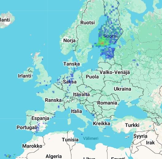
 Corvo to
  Cape Greco (or even the Karpas Peninsula, in Northern Cyprus, where the euro is not official), and from
  Nuorgam to
  I agree that it would make more sense if the whole Eurozone were visible on the map. Also, this is purely subjective, but I think it would look more aesthetically pleasing if Iceland were not cut in half.